
Lake Lauvitel
- Isabelle Lemoine
- Nov 10, 2025
- 1 min read


 |  |  |  |  |
Departure/Arrival : | Distance | Duration | Season | Difficulty |
5,9 km | 3h | À l'année | Intermediate |
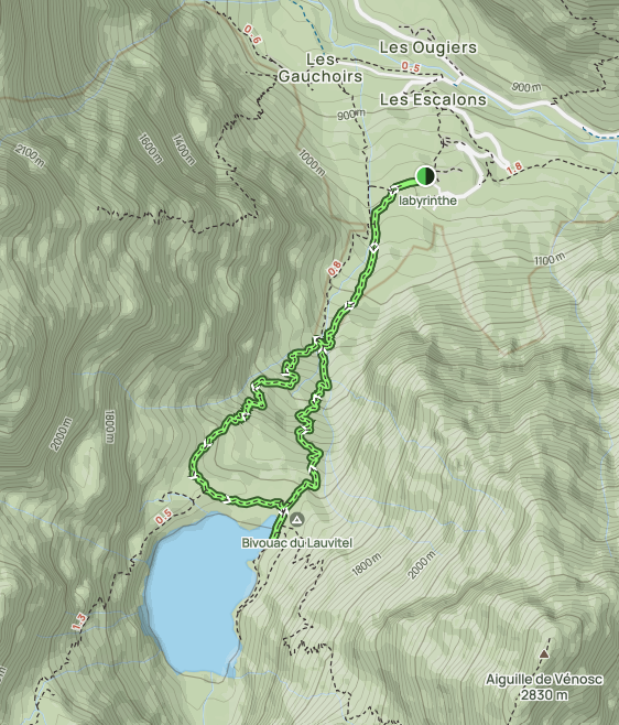
During one of our trips to France, we discovered this magnificent hike that leads to Lake Lauvitel at over 1,500 meters above sea level in the Écrins National Park. It is the largest and deepest high-altitude lake in the park's mountain range.
The trailhead is located in the hamlet of La Danchère. With an elevation gain of 560 meters, it takes about 1.5 hours to reach the lake shore. During the ascent, the hiker walks partly through woodland, crosses several streams, and eventually arrives at a lake with turquoise waters surrounded by several peaks.
We did this hike in the summer, and it was particularly hot. A good pair of shoes, hiking poles, and plenty of water were necessary. The efforts were amply rewarded by the splendid view of the lake.
Été


Comments